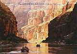
INFORMATIVE DETAILED RIVER MAPS to guide you through the Canyon with beautiful shaded-relief topographic maps
ACCURATE CAMPSITE, RAPIDS AND OTHER FEATURE LOCATIONS with USGS Mileage Points
FULL-COLOR GEOLOGY DIAGRAMS to explain the Canyon’s rock history
EARLY EXPLORATION AND HISTORY including John Wesley Powell and numerous others who explored the river and canyon
HISTORY OF INDIGENOUS PEOPLES AND CULTURES, the Canyon’s first inhabitants
PLANTS AND ANIMALS OF THE CANYON with full-color photos and descriptions to help identify the flora and fauna
WHITEWATER WORKSHOP to teach the basics of river features and an intro to boating whitewater
WATERPROOF BOOK made to last and be used on the river!
2018 Update of Belknap's Waterproof Grand Canyon River Guide. New edition features 8 additional pages: Now includes Glen Canyon Dam to Lake Mead; New Read-as-you-Run Format; Photo Geology Labeling now from Lees Ferry to Mead. This mile-by-mile color Waterproof Guide to the Colorado River through Grand Canyon features shaded relief/topographic maps, and special sections on history, archaeology, geology, natural history and photography. Updated yearly with campsites and new USGS Mileage Points: Geology section features step-by-step easy to understand description of how the Canyon was formed as well as color photos from river level with formations clearly labeled for easy identification.