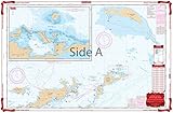
Franko's Map of The British Virgin Islands
This is one of the most unusual of Franko's Maps, because it took so-o-o long to complete it (over three years in the making), and it included so much input from the locals (almost every bit of information on it has been given to me or has been carefully scrutinized by the local BVI people, specifically the British Virgin Islands Dive Association, which is all of the dive shops and some of the dive live-aboard boat operators. BVI was a huge undertaking and it turned out better than good! In fact, I think it is better than better than good! It is an outstanding, accurate chart of the islands, and it is a good map of the roads and features of each island as well. Every notable scuba and snorkeling site is shown, as are main boating routes. This is the coolest map! It is also interesting in that I utilized no digital data for it's production, so it was produced in a less technical way than many of my maps. It is entirely a tracing of British Government charts, with the shaded relief of the islands and the descending hues of ocean blue entirely done by yours truly, by hand on the computer. It is literally a work of art.