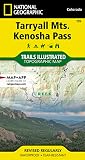
Outdoor Trail Maps LLC Lost Creek Wilderness - Colorado Topographic Hiking Map (2022)
R 675
or 4 x payments of R168.75 with
Availability: Currently in Stock
Delivery: 10-20 working days
Outdoor Trail Maps LLC Lost Creek Wilderness - Colorado Topographic Hiking Map (2022)
Waterproof, tear-resistant, 1:48,000 scale with a compact 4"x7" folded size for your pocket
Smaller and lighter - no more unfurling huge maps - designed for on-trail use
Segment distances - mileage - for all trails
Updated for 2018 with accurate trail routings and distances
GPS coordinates for trailheads and trail junctions - device compatible
Waterproof, tear-resistant topographic hiking map covering all of the hiking trails in the Lost Creek Wilderness of Colorado just southwest of Denver, including the Kenosha Mountains, Platte River Mountains and Puma Hills. The front side of the map covers the western portion of the wilderness, including the Ben Tyler Trail, Craig Creek Trail, the Brookside-McCurdy Trail, etc just south of Bailey, CO. The back of the map shows the eastern and southern portion of the wilderness including the Hankins Pass area, Goose Creek and Lost Park hiking loops, among others.